High-Tech Vehicle Pays Visit to College
01/25/2012
A high-tech vehicle visited SUNY Cortland and introduced the College’s Geography Department to the potential pavement impact of heavy trucks on Thursday, Jan. 26.
Mandli Communications, a leading research and technology developer in the transportation industry, offered a 40-minute presentation in SUNY Cortland’s Geographic Information Systems (GIS) Lab to College faculty and staff as well as local highway supervisors from Cortland County.
“Any time you can get better information about your pavement condition, you take it,” said David Miller, a distinguished teaching professor in the College’s Geography Department. “This technology makes sure anyone who’s responsible for adding above-average wear to the roadway is accountable, in a fair way, for assisting with the cost of repairs.”
He explained that heavy hauling trucks require a permit, which specifies the roadway they must travel on, how many trips the truck will be making and the weight of the vehicle.
“We know what past traffic volume has been and the highway maintenance scenario under those pre-existing levels of traffic,” Miller said. “If you have hard data and past practice data, you can establish reasonably who’s responsible for additional wear and tear on the roadway.”
Hydraulic fracturing, for instance, better known as hydrofracking, utilizes tanker trucks that carry thousands of gallons of fluid. The weight of those trucks — or any large vehicle that carries heavy loads — can cause cracks and potholes on the road surface. Central New York weather, especially the constant freezing and thawing that takes place in the late spring and early winter, only complicates matters.
 |
|
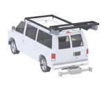
A representative from Mandli Communications
introduces a high-tech vehicle to College
faculty, staff and local highway supervisors
from Cortland County.
|
The data collection vehicle’s visit was important because it introduced faculty and staff members to a progressive technology that eventually could bolster the learning experience of SUNY Cortland geography students.
“We’re looking as entrepreneurs at programs and technology that can add skills for our students,” said Scott Anderson, associate professor and chair of the Geography Department.
The long-term goal is to get students comfortable using new hardware and analyzing their findings in the GIS Lab, Miller said.
“We’ve been using geographic information system and global positioning system data here, in an integrated way, for 20 years or so,” he said. “This is Cortland staying on the cutting edge of a smart technology.”
The machinery used for studying the road is rear-mounted on the vehicle. A Laser Crack Management System (LCMS) utilizes high-speed cameras, custom optics and laser line projectors to acquire two-dimensional images and three-dimensional profiles of the road. Various pavement types can be measured at speeds up to 70 miles per hour.
Although the hardware sounds complex, Miller said the payoff is simple: it’s a safe, automated way to detect cracks in the pavement. And eventually, the technology would lead to cost savings, mostly in the form of time and labor.
“There’s a good bit of data suggesting that these systems would automate this labor intensive process and give a good return on investment,” Miller said. “The quality of the data allows for more targeted decisions with respect to maintenance, and that can result in considerable savings.”
Typically, transportation departments rely on a pavement management system to prioritize roadwork and optimize repair funds. Mandli, which is based in Madison, Wis., has consulted with several state departments of transportation while collecting pavement data for more than 20 years. Miller said New York state monitors its major roadways with a similar form of technology, but not every local road gets tested.
He was quick to point out that the machinery is not a replacement for the human knowledge that town highway supervisors and workers hold. The technology does, however, make their jobs safer.
Workers often count and measure pavement cracks from the side of busy roadways, using measuring sticks and wheels.
“That’s dangerous, being out along the road like that,” Miller said. “(LCMS) makes the data collection process safer and it brings down the cost dramatically.
“Systems like these allow local governments to make decisions with better data rather than projections based on limited sampling.”